Salt Lakes in Australia
Australia is a big, dry place and there are numerous large dry / salt lakes, listed here are some of those, more particularly those suited or investigated for dry lakes racing.
Here's a list of Lakes of Australia - https://en.wikipedia.org/wiki/List_of_lakes_of_Australia
| Name | State | Size | Elevation | Owner | Access |
|---|---|---|---|---|---|
| Lake Amadeus | Northern Territory | 180km long and 10km wide ( 1032 sq. km) |
|||
| Lake Ballard | Western Australia | 50 km long x 20 km wide 4,900 hectares (12,108 acres) |
|||
| Lake Barlee | Eastern Australia | 100 km wide from west to east, and about 80 km wide from north to south 1,980 square kilometres (764 sq mi) |
|||
| Bulloo Lake | New South Wales - Queensland border | (832.5 km²) | 290 m (950 ft) | ||
| Lake Cadibarrawirracanna | South Australia | length of 32 kilometres (20 mi), a width of 9.7 kilometres (6 mi) 220 km² |
96 m | The lake is located within the boundaries of the Anna Creek Station pastoral lease and has public access established under the Pastoral Land Management and Conservation Act 1989 via an access road connecting to the Coober Pedy to William Creek Road about 6.5 kilometres (4.0 mi) to the south. | |
| Lake Carey | Western Australia | 65 kilometres long 6,000 square kilometres (2,300 sq mi) |
|||
| Lake Disappointment | Western Australia | 160 km (99 mi) long 33,000-hectare (82,000-acre) |
325 metres (1,066 ft) | ||
| Dumbleyung Lake | Western Australia | 13Km x 6.5Km (52Km²) | |||
| Lake Dundas | Western Australia | ||||
| Lake Eyre (Kati Thanda) | South Australia | Lake Eyre North, 144 kilometres (89 mi) in length and 65 kilometres (40 mi) wide, and Lake Eyre South, 65 by 24 kilometres (40 by 15 mi) (9500 sq. km) |
49 ft (16 m) (AHD) below sea level | Vehicles banned | |
| Lake Frome | South Australia | 100Km x 40Km (259,615 hectares) |
1 metre (3 ft 3 in) | Vehicles banned | |
| Lake Gairdner | South Australia | 168Km x 48Km (160Km²) | 121 m (397 feet) | Agreement with DEH for Speed Week | |
| Lake Galilee | Queensland | Lake Galilee is approximately 29 km long but the width varies between 3 km and 15 km. ( 260 km²) |
275 m | It is the only wetlands area in central Queensland and consequently is the home of a large waterfowl population. It has been identified by BirdLife International as an Important Bird Area (IBA) because it regularly supports over 1% of the world populations of Freckled Ducks and Grey Teals. | |
| Lake George | New South Wales | Length: 25 km Width: 10 km | 600 m Mean depth 1 m |
Lake George is a lake in south-eastern New South Wales, Australia. It is about 40 kilometres north-east of Canberra along the Federal Highway en route to Sydney. Due to the ongoing drought in Australia, Lake George dried out completely in November 2002, and remained so until February 2010 when it started to refill. The previous time the lake had dried out completely was during a severe drought in the 1940s, although it was partially dry in 1986, leaving large pools of water. When the lake is empty it is used by farmers to graze sheep and cattle. During September 2016, the lake filled for the first time since 1996. In the intervening years the level of water in the lake had never been as high as that in September 2016. |
|
| Lake Gregory | South Australia | 26 kilometres (16 mi) long 14 kilometres (9 mi) wide 290 square kilometres (113 sq mi) |
Lake Gregory is a salt lake in northern South Australia. It lies to the west of Lake Blanche; to the east the Birdsville Track runs in between it and Lake Eyre. It is named after the explorer A. C. Gregory, who first passed by it in 1858. Originally Lake Eyre was named Lake Gregory by B. H. Babbage, but the names were modified by Governor Richard Graves MacDonnell, who preferred to name the former after the famous explorer who first investigated the region twenty years prior, Edward John Eyre. | ||
| Goyder Lagoon | South Australia | 12m above sea level | It is located within the gazetted locality of Clifton Hills Station which is occupied by the pastoral lease of the same name. | ||
| Lake Hart | South Australia | a lake within the Woomera Test Range | |||
| Lake Hindmarsh | Victoria | 135 km² Length: 22 km Width: 7 km Catchment area: 23,500 km² | Parks Victoria | ||
| Island Lake | |||||
| Lake Lefroy | Western Australia | 40Km x 510 square km |
309m above sea level | ||
| Lake Macleod | Western Australia | ||||
| Lake Mungo | New South Wales | ||||
| Lake Omeo | Victoria | 683m above sea level | |||
| Lake Perkolilli | Western Australia | ||||
| Lake Torrens | South Australia | (5,700Km²) | |||
| Lake Tyrrell | Victoria | 208.6 km² | 40.2m above sea level | ||
| Willandra Lakes | New South Wales | ||||
| Lake Woods | Northern Territory | ||||
| Lake Yamma Yamma | Queensland | 69,000 ha (690 km² 270 sq mi) | |||
| Pink Lakes | Victoria | In overcast weather, this group of lakes in Murray-Sunset National Park has a startling colour range, from dusky mauve to bubblegum pink. The lakes' hues are caused by a chemical compound exuded by Dunaliella salina, an algal species that inhabits saline waters. |
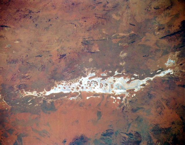
Lake Amadeus
Northern Territory
north of Yulara
Halting explorer Ernest Giles in his 1872 exploration of the area, Lake Amadeus is a 1032 sq. km saltpan that's part of a 500 km east-flowing drainage system that eventually connects to the Finke River.
Lake Amadeus is a huge salt lake in the area of Uluru (Ayers Rock), located in the southwest corner of Australia's Northern Territory. Due to the aridity of the area, it is usually almost totally dry.
Nearby landmarks are: Uluru (Ayers Rock), Kata Tjuta (Olga Rocks) and Mount Conner.
It was discovered by the explorer Ernest Giles, who had originally intended to honour his benefactor Baron Ferdinand von Mueller with the eponym Lake Ferdinand. However Mueller prevailed upon Giles to instead honour King Amadeus of Spain, who had previously bestowed honour on him.
Lake Amadeus is 180km long and 10km wide, making it the largest salt lake in the Northern Territory. It contains up to 600 million tonnes of salt, however harvesting it has not proved viable due to its remote location. The water table is about 300 millimetres below the lake floor, shallow enough for the water to be evaporated. The lake occasionally fills when heavy rains occur but it is usually dry.
256 km Alice Springs Radar Loop
Lake Ballard
Lake Ballard is an ephemeral salt lake in the Goldfields-Esperance area of Western Australia about 50 kilometres (31 mi) West of Menzies.
In 2003, to commemorate the 50th anniverary of the Perth International Arts Festival the Inside Australia exhibition was commissioned. The artist and Turner Prize winner Antony Gormley installed 51 sculptures (cast from moulds created from digital scans of unclothed residents from the town of Menzies, 30 km to the south-east) over an area of 10 square kilometres (4 sq mi) on the bed of the lake. The statues were to be removed at the conculsion of the festival but remain as a tourist exhibition.
The lake is used as a breeding site for Banded Stilts following major flood events. The stilts nest in large close-packed colonies on low islands in ephemeral inland salt lakes such as Lake Eyre, Lake Barlee and Lake Ballard. The last recorded nesting on the lake was in 1995 following the aftermath of Cyclone Bobby. The lake, along with the neighbouring Lake Marmion some 20 km to the east, has been identified by BirdLife International as a 984 km2 Important Bird Area (IBA), because it has supported a high proportion of the known Banded Stilt mass breeding events.

Lake Barlee
Western Australia
west of Leonora
Lake Barlee is an intermittent salt lake in Western Australia. It is about 150 km east of Paynes Find and west of Leonora on the border between the Shires of Sandstone and Menzies. Lake Barlee is more than 100 km wide from west to east, and about 80 km wide from north to south. The lake is usually dry. It fills about once every ten years on average, after which the water persists for a little less than a year. When it is inundated it becomes an important breeding site for waterbirds.
Lake Barlee was discovered by John Forrest in 1869. Forrest's party, who were searching for the long lost explorer Ludwig Leichhardt, became bogged while trying to cross the salt lake on 19 March. After extracting their horses from the bog, they skirted the lake for nearly a week. On 25 March, Forrest climbed a hill in the area and saw the great extent of the lake. He then named it after Frederick Barlee, the Colonial Secretary of Western Australia.
Bulloo Lake
New South Wales - Queensland border
| Area Type: | Hydrographic |
| Location Type: | Lake |
| Latitude: | 28.7707� S |
| Longitude: | 142.3333� E |
| Latitude (DMS): | 46' 14.54" S |
| Longitude (DMS): | 142� 19' 59.71" E |
| Altitude: | 0 |
Lake Cadibarrawirracanna
South Australia
east of Coober Pedy
Lake Cadibarrawirracanna ( [show location on an interactive map] 28�50?S, 135�26?E) is a salt lake in central South Australia. It is located in the northeastern portion of the Woomera Prohibited Area, east of the Stuart Highway. Lake Cadibarrawirracanna, meaning stars dancing on water, holds the record for the longest place name in Australia.
Lake Carey
Western Australia
East of Leonora
Lake Carey, (29�5?4?S 122�18?56?E? / ?-29.08444, 122.31556), is a salt lake 80 kilometres (50 mi) south of Laverton, Western Australia within the Laverton Tectonic Zone, that has been associated with the presence of gold since the 1890s [1] and recently there has been renewed exploration drilling. Midas, the company who have sponsored the drilling, estimates that there may be 25 million ounces (780 tonnes) of gold [2] within the site. It has also been reported that there may well be significant amounts of nickel and zinc.
The Wangkathaa people are associated with the land around Lake Carey
Lake Disappointment
Western Australia
east of Newman
Lake Disappointment is an ephemeral salt lake in a remote area of Western Australia.
Lake Disappointment was named by the explorer Frank Hann in 1897. Hann was in the area exploring the east Pilbara, around Rudall River. He noticed creeks in the area flowed inland, and followed them expecting to find a large fresh-water lake. To his disappointment the lake turned out to be salt.
The lake is home to many species of waterbirds.
The Lake Disappointment project is comprised of 7 Exploration Licenses covering 1600sqkm's over the playa lake of the same name. An Access and Heritage agreement was executed, in February 2006, between the Martu People and the Company in respect of Exploration Licenses E69/2156-2159 and E45/2801-04.

Dumbleyung Lake
Western Australia
south west of Dumbleyung
Dumbleyung Lake, also widely known as Lake Dumbleyung, is a salt lake in Western Australia. It is located at [show location on an interactive map] 33�20?00?S, 117�39?00?E, in the Great Southern region of Western Australia. At 13 kilometres long and 6.5 kilometres wide, it covers an area of 52 km².
The explorers Henry Landor and Henry Maxwell Lefroy are usually credited with the discovery of Dumbleyung Lake, although it appears to have been shown on a map in 1839 with the name Kondening Lake. Grazing leases around the lake were first granted to George Kersley in 1875.
Dumbleyung Lake received world recognition when Donald Campbell broke the world water speed record on it on 31 December 1964, travelling at 444.66 km/h (276.3 mph) in his boat Bluebird K7. A granite memorial to Campbell can be seen at Pussy Cat Hill, a prominent feature and vantage point to view the entire lake area.
In recent times, the increased soil salination has made the area unsuitable for grazing. Today the lake is mainly used for aquatic recreation. Despite the extreme salinity of the lake, it provides a habitat for many varieties of water birds, and since 1963 has been protected by the Dumbleyung Lake Nature Reserve.

The Racing Campbells - Lake Dumbleyung
Lake Dundas
Western Australia
east of Dundas
Lake Eyre
South Australia
north of Roxby Downs
Lake Eyre is the lowest point in Australia, at approximately 15 m (49 ft) (AHD) below sea level, and, on the rare occasions that it fills, the largest lake in Australia. It is the focal point of the vast Lake Eyre Basin and is found some 700km north of Adelaide.
Completely filled only three times in the past 150 years, Australia's 9500 sq. km salty "dead heart" - which comprises Lake Eyre North and Lake Eyre South - is devoid of vegetation. Before the advent of GPS, explorers of this expanse of white could only navigate by compass, as if they were at sea.
The lake was named after Edward Eyre who was the first European to sight it in 1840. The lake is located in the deserts of central Australia, in northern South Australia. The Eyre Basin is a large endorheic system surrounding the lakebed, the lowest part of which is filled with the characteristic playa salt pan caused by the seasonal expansion and subsequent evaporation of the trapped waters. Even in the dry season there is usually some water remaining in Lake Eyre, usually collecting in a number of smaller sub-lakes on the playa.
During the rainy season the rivers from the northeast (in outback Queensland) flow towards the lake through the Channel Country. The amount of water from the monsoon determines whether water will reach the lake and if it does, how deep the lake will get. In strong La Ni�a years the lake can fill. Since 1885 this has occurred in 1886/1887, 1889/1890, 1916/1917, 1950, 1955, 1974 - 1976 [1], with the highest flood of 6m in 1974. Local rain can also fill Lake Eyre to 3-4m as occurred in 1984 and 1989. Wave built shingle terraces on the shore suggest that during the Medieval Warm Period and centuries immediately prior Lake Eyre possibly held permanent water at levels above those of 1974. Torrential rain in January 2007 took about six weeks to reach the lake but put only a small amount of water into it.
Typically a 1.5 m (5 ft) flood occurs every three years, a 4 m (13 ft) flood every decade, and a fill or near fill four times a century. The water in the lake soon evaporates with a minor and medium flood drying by the end of the following summer.
The Lake Eyre Basin has a drainage basin that covers one-sixth of all Australia. It is one of the largest internal drainage systems in the world, and covers roughly 1.2 million square kilometres, including much of inland Queensland, large portions of South Australia and the Northern Territory, and a part of western New South Wales.
All the riverbeds in this vast, mostly flat, arid and semi-arid area lead inland (not towards the sea) and on those fairly rare occasions when there is sufficient rainfall to make the rivers flow at all, they flow towards Lake Eyre in central South Australia.
Lake Eyre itself lies 20 metres below sea level, and usually contains only salt. In flood years it fills and for a short time undergoes a period of rapid growth and fertility: long-dormant marine creatures multiply and large flocks of waterfowl arrive to feed and raise their young before the waters evaporate once more.
None of the creeks and rivers in the Lake Eyre Basin are permanent: they flow only after heavy rain�a rare to very rare event in the arid interior of Australia. Average annual rainfall in the area surrounding Lake Eyre is 125mm (5 inches), and the pan evaporation rate 3.5 metres (about 11 feet). Annualised average figures are misleading: since 1885 average rainfall over the 1,100,000 square kilometres of the Lake Eyre Basin has ranged from about 45 millimetres (less than 2 inches) in 1928 to over 760 millimetres (30 inches) in 1974. Most of the water reaching Lake Eyre comes from the river systems of semi-arid inland Queensland, roughly 1000 kilometres to the north.
Lake Frome
South Australia
east of Leigh Creek
(30�37?S, 139�52?E) is a large endorheic lake in South Australia, east of the Northern Flinders Ranges. It is a large, shallow, unvegetated playa or saltpan, 100 km long and 40km wide, lying mostly below sea level and having a total surface area of 259,615 hectares. It only rarely fills with brackish water flowing down usually dry creeks in the Northern Flinders Ranges from the west, or exceptional flows down the Strzelecki Creek from the north.
It was named after Edward Charles Frome after his mapping of the area in 1843.
The lake adjoins Vulkathunha-Gammon Ranges National Park to its west and lies adjacent to Lake Callabonna linked by Salt Creek to its north, the southern Strzelecki Desert to its east, and the Frome Downs pastoral lease to its south. The region in which it is situated has little rainfall and is very sparsely settled, with the closest settlement to it being Arkaroola Village some 40 kilometres north-west of its closest shore. Two significant uranium desposits near Lake Frome are being exploited by the hydrometallurgical process of in-situ leaching: Beverley to its north-west and Honeymoon to its south-east.
Due to its "regional geological significance" the lake was proclaimed as the Lake Frome Regional Reserve (IUCN Category VI) in 1991.
Public road access to Lake Frome is limited to a single, rough four-wheel drive track which commences from the Vulkathunha-Gammon Ranges National Park headquarters at Balcanoona (Virlkundhunha) station 30 kilometres west. The route to Lake Frome traverses flat, stony terrain following Balcanoona Creek through the only completely protected arid catchment in Australia.[2]. After crossing both the Moomba-Adelaide natural gas pipeline and the dingo fence the track passes over low sand dunes before arriving at the western shore of Lake Frome. The protected area through which this access track travels is declared a Cultural Use zone for hunting by the local Adnyamathanha Aboriginal people between 3.00 pm and 5.00 am; during this period public access is prohibited.
Lake Frome forms part of the local Dreaming story told by the Adnyamathanha people explaining how the region's geology and species originated. According to this Dreaming story[4], Lake Frome was emptied of its water by the Rainbow Serpent Akurra when he ventured down Arkaroola Creek (which flows onto Lake Frome) to drink. Due to its Dreamtime significance the Adnyamathanha do not venture onto the lake's surface.
Lake Gairdner
South Australia
south west of Woomera
Lake Gairdner ( [show location on an interactive map] 31�34?S, 136�00?E) is a large endorheic lake in central South Australia, and is considered the fourth largest salt lake in Australia when it is flooded.
The lake is over 160 km (100 miles) long and 48 km (30 miles) across with salt over 1.2 metres (4 feet) thick in some places. It is located west of Lake Torrens, 150 km northwest of Port Augusta and 440 km northwest of Adelaide. It is located in the Gawler Ranges.
Lake Gairdner was named by the Governor of South Australia, Richard MacDonnell in October 1857 after Gordon Gairdner, a Chief Clerk of the Australian Department in the Colonial Office. It has been a site for various land speed record attempts on its salt flats.
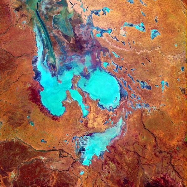
Goyder Lagoon
South Australia
Goyder Lagoon is a locality just off the Diamantina River in northeast South Australia, Australia situated about 910km north of Adelaide. Goyder Lagoon is at an elevation of approximately 27m above sea level. Goyder Lagoon is one of the northernmost localities in South Australia. The nearest ocean is the Southern Ocean about 650km south-southwest of Goyder Lagoon.
The nearest more populous place is the village of Thargomindah which is 470km away with a population of around 210
The flood plains of Goyder's Lagoon, north of Lake Eyre in South Australia, September 2009.

Thousands of tendrils of water flood into Goyder's Lagoon in outback South Australia in June 2010.
Lake Hindmarsh
Lake Hindmarsh is a seasonal lake and can remain dry for several years between floods.
When filled, Lake Hindmarsh is Victoria's largest freshwater lake an extremely popular spot for holiday makers, teeming with wildlife. Fringed by ancient River Red Gums and fed by the Wimmera River, this huge lake is shared by parrots, pelicans, sea eagles, anglers and water sports enthusiasts alike. The Wimmera River originates on the Great Dividing Range near Beaufort and ends in a series of "terminal lakes", including Lake Hindmarsh, Lake Albacutya and finally, the Wyperfeld flood plains.
Island Lake
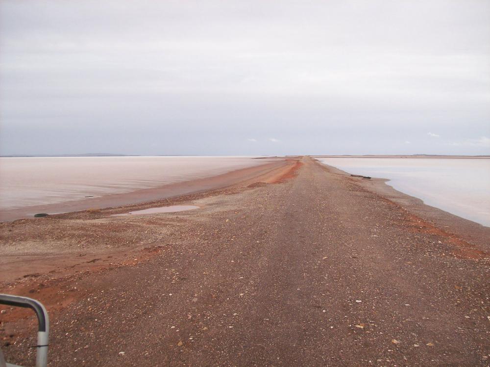
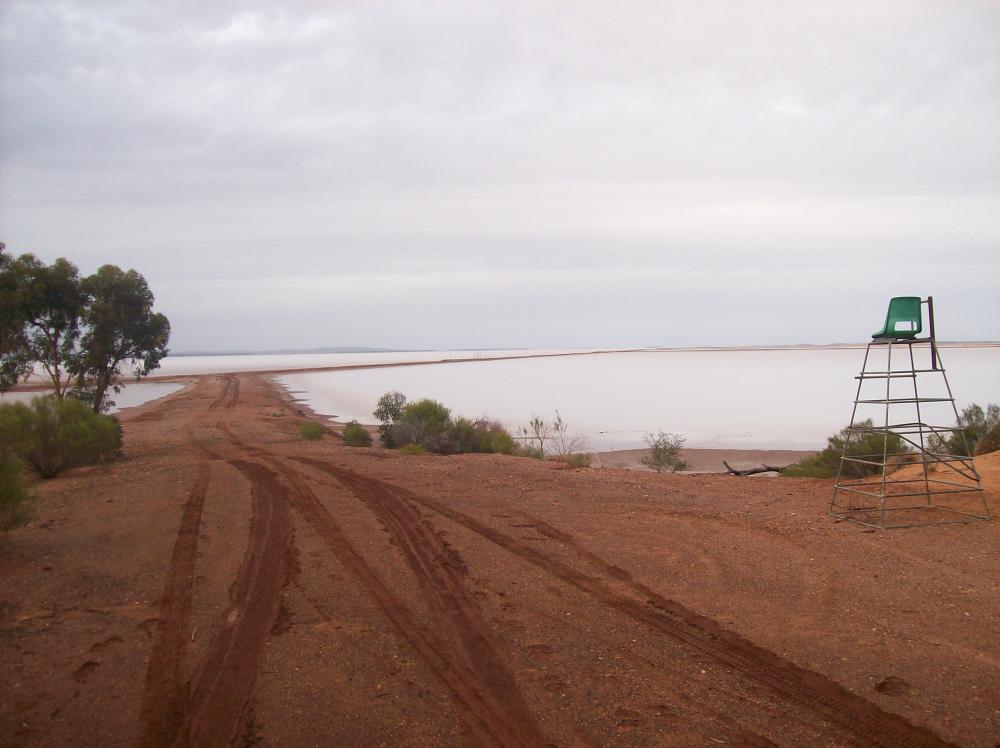
Lake Lefroy
Western Australia
east of Kambalda
40km long x ? wide
309m above sea level
Apart from the lake itself, advantages and facilities available are it is at the doorstep of a mining town called Kambalda, has sealed access roads, fresh water, ambulance service( I think) and a hotel. 60km away is the city of Kalgoorlie which is a major regional centre and has good transport - road, rail (Indian Pacific and freight trains) major airport, hotels, motels, sporting facilities and parks, fresh water, many engineering and supply outlets, major hospital, land ambulance, flying doctor. Home to the bi-annual Pacific Rim Landsailing Championships hosted by the Sandgropers Land Yacht Club. Last held in 2006. The worlds best land sailing surface!
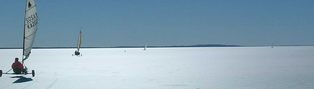

Windjet at Lake Lefroy
Lake Lefroy 2005
The causeway goes out about 4 km into the lake
This picture is looking from the camp site out onto the lake.As you can see it has just rained but I drove out 5 km out onto the causeway with no problems. I walked onto the lake and the salt was bloody hard.
Close up picture of the surface of the lake


More pictures from the 2006 Land Sailing Championships
Salt harvesting at Lake Lefroy in the 1940-50's
Weather at Kambalda/Lake Lefroy
256 km Kalgoorlie Radar Loop
Lake Macleod
Western Australia 6701
Lake Macleod (located at [show location on an interactive map] 24�10S 113�30E / -24.167, 113.5) is the westernmost lake in Western Australia. It is located north of the small coastal city of Carnarvon, estimated population 7,200.
Climatically, this part of Western Australia is greatly influenced by the north-flowing Western Australian current that brings cool water northward from Antarctica, which is not conducive to producing inland precipitation. This cool offshore current, coupled with a very flat coastal plain, contributes to the near-desert-like conditions along the coastal region as evidenced by the brown landscape around the lake and the highly reflective salt beds within the lake.
The low point in the lake appears to be near the northern end where the light blues indicate some standing water. Close inspection discloses very faint lines at the southernmost end of Lake Macleod where large evaporation beds are used for the production of high-quality salt and gypsum. Dirk Hartog, a Dutchman, made the first authenticated landing by a European along this coastline in 1616. Early explorers recorded phenomenal tidal ranges along this coastal area.
Lake Mungo
New South Wales
north of Arumpo
Lake Mungo is a dry lake in south-western New South Wales, Australia. It is located about 740 km due west of Sydney and 90 km north-east of Mildura. The lake is the central feature of Mungo National Park, and is one of seventeen lakes in the World Heritage listed Willandra Lakes Region. Many important archaeological findings have been made at the lake, most significantly the discovery of the remains of Mungo Man, the oldest human found in Australia, and Mungo Lady, the oldest person in the world to be ritually cremated.
Sediments at Lake Mungo have been deposited over more than 100,000 years. On the eastern shore of the lake are the 'Walls of China', a 26 km long series of lunettes, about thirty metres high, formed over thousands of years. There are three distinct layers of sands and soil forming the Walls. The oldest is the reddish Gol Gol layer, formed between 100,000 and 120,000 years ago. The middle greyish layer is the Mungo layer, deposited between 50,000 and 25,000 years ago. The most recent is the Zanci layer, which is pale brown, and was laid down mostly between 25,000 and 15,000 years ago.
The rich archaeological heritage of the site is very significant to the Aboriginal Australian people from the area. The Willandra region is inhabited by the Barkindji, Nyiampaa and Mutthi Mutthi peoples, who have now entered Joint Management Agreements with the Government of New South Wales to manage the lake and the Mungo National Park.
Lake Omeo
Victoria
One kilometre West of Benambra.
The town of Benambra is on the shores of Lake Omeo which can also serve as a tourist attraction, however this lake only irregularly holds water at present. During wetter times a pier and public toilets were built at the top end of the lake furthest from the town where the lake is at its maximum depth. The depth varies when full from about 3m at the top end to about 1m at the town end, where the lake will flood across the sealed road. When holding sufficient water, the lake has hosted sailing, and, later, speed boat races; the last speed boat races were held on Australia Day in January, 1975.
Lake Omeo, to the northeast of the town, is a salt lake in an extinct volcano, where there is a tremendous variety of birdlife.
See more info and recent photos here.
| Abstract: | Lake formed through the defeat of a stream by back tilting along the Morass Creek Fault. |
|
Access: |
Blowhard Road. |
|
Ownership: |
The Lake is Crown Land while all the surrounds are privately owned. |
|
Geology: |
Lake Omeo occupies a basin cut in Ordovician schists and granitic rocks, which outcrop in steep bluffs to the west and north of the Lake. The eastern side of the lake basin is bounded by a ridge of Ordovician sediments, a small horst block, which separates the lake from the Morass Creek alluvial flats. |
|
Geomorpholgy: |
Like Omeo originated through the damming of a small tributary of Morass Creek as a result of back tilting along the faults to the east of the lake. Another small tributary north of Lake Omeo, was diverted into the lake by fault movement. The lake basin is a broad flat plain which is only inundated during periods of high rainfall . It is bordered on the south-east by an arenate ridge of silts, clays and sands which separate the lake from swamp and alluvial terrace deposits to the east. The ridge has the form and composition of lunette. Small, well-developed lakeshore terraces occur around the lake and are prominent on the northern and eastern shores. Narrow gravel beaches composed of schist fragments and quartz occur at the base of the bluff on the western lake shoreline. |
|
Significance: |
State. Outstanding example of a lake basin developed by drainage disruption due to faulting. The crescentic ridge on the eastern side of the lake described as a lunette, is a unique landform in the highlands of eastern Victoria. The lake shore features display contrasting phases of lake evolution including periods of deep water (eg. Wave cut shoreline terrace) and more arid phases leading to lunette development. |
|
Management: |
The significance of the site requires the preservation of the lake shore features. |
|
References: |
Hills (1975) |
|
Lake Perkolilli
Lake Torrens
South Australia
east of Woomera
Lake Torrens is a 5,700 square kilometre endorheic saline rift lake in South Australia. It forms part of the same rift valley that includes Spencer Gulf to the south and is approximately 240 km long. It is in the Lake Torrens National Park, and a permit is required to visit.
Lake Torrens is usually a dry salt flat. It has only been filled with water once in the past 150 years. It lies 345 km north of Adelaide. Discovered by Edward John Eyre in 1839, for the following twenty years it was believed that Lake Torrens was an enormous horseshoe-shaped saltpan encircling the northern Flinders Ranges and blocking any path to the interior. The first European to penetrate the mythical barrier was A. C. Gregory from the north in March 1858; later the same year, an expedition under B. H. Babbage and Major Warburton in the north-west also crossed the non-existent barrier near modern Marree. Eyre's horseshoe lake was actually composed of Lake Frome, Lake Callabonna, Lake Blanche, Lake Gregory, Lake Eyre South, and Lake Torrens itself.
Lake Tyrrell
Victoria
North of Sea Lake
Lake Tyrrell is dry most of the year, although at times it may be covered by shallow water. Evaporation leaves a salt crust which is commercially extracted by the Cheetham Salt Works at the northern end of the lake. Over 100,000 tonnes of salt is extracted from the lake each year. The first recorded salt harvest from Lake Tyrrell was in 1896. To read an article from the Herald-Sun about Lake Tyrrell follow this link. Small islands in the lake are used as a breeding ground by thousands of seagulls. The saltbush and samphire around the lagoon support a range of wildlife while the lunette to the east contains significant Aboriginal relics.
Willandra Lakes
New South Wales
north of Arumpo
The Willandra Lakes Region is a World Heritage Site that covers 2,400 square kilometres in south-western New South Wales, Australia.
The Region has important natural and cultural values including exceptional examples of past human civilization including the Worlds oldest cremation site. A small section of the Region is protected by the Mungo National Park.

Lake Woods
Pamayu 0852
Northern Territory
Area Type: Hydrographic
Location Type: Lake
Latitude: -17.9
Longitude: 133.4333
Latitude (DMS): 17� 53' 60 S
Longitude (DMS):133� 25' 60 E
Lake Woods is located immediately west of the Stuart Highway and 7 km south of the small township of Elliot. The site includes the lower reaches of Newcastle Creek, including two near-permanent waterholes (Longreach and South Newcastle), a delta of distributary channels where the Creek meets the lake, and the lake to the maximum high water mark.
The Ashburton Range clearly delineates the east side of the site, but low relief on the west side of the lake means that this boundary is less well defined. The lake most frequently occupies an inner basin of about 350 km� but the boundary of this site has been delineated based on the maximum flooded area of the lake with a 2 km buffer, and encompasses an area of 1305 km�.
Lake Woods is primarily fed by Newcastle Creek from a large catchment to the north-east. Surface inflows are highly variable, although the creek does flow in most years. Large floods often cause at least partial inundation of the lake, but major floods which fill the lake to capacity have occurred at least three times in the past 15 years (1993, 2001 and 2006). Although the lake is shallow (2-3 m), water can persist for more than 12 months after major flood events.
Other large wetlands on the Barkly Tableland including the Lake Sylvester system, Tarrabool Lake and Eva Downs Swamp are also recognised as sites of high conservation significance in the NT.
Lake Yamma Yamma
Lake Yamma Yamma is an ephemeral lake on the Cooper Creek system in the arid Channel Country of south-western Queensland, Australia. The lake, which is sometimes called Lake Mackillop, is the largest inland ephemeral lake in Queensland.
The lake only holds water following major floods on Cooper Creek. When filled the lake covers 69,000 ha (690 km2; 270 sq mi). It fills to capacity only about once every 25-30 years, most recently in 2000. The lake waters are fresh immediately after filling, but become increasingly saline as the lake dries out. When dry, the lake bed�s cracking grey clay soils support extensive grasslands dominated by Rat's Tail Couch. Several ephemeral forbs grow among the couch following rain or minor flooding. The north-eastern section supports open Lignum shrubland with patches of open woodland dominated by Coolabah and Belalie.
The lake, with its associated seasonal claypans and the nearby Barrolka Lakes to the north-east, has been identified by BirdLife International as a 1,218 km2 (470 sq mi) Important Bird Area (IBA) because it has supported over 1% of the world populations of Plumed Whistling-Ducks, Sharp-tailed Sandpipers and Australian Pelicans, as well as providing habitat for Australian Bustards. A large colony of Australian Pelicans breeds on an island at the north-eastern end of the lake. The Barrolka Lakes hold several cormorant colonies. Other birds recorded in substantial numbers include Hardheads, White-headed Stilts, Glossy Ibises, Grey Teals, Black-tailed Nativehens, Australian Pratincoles, Whiskered Terns and Pacific Black Ducks, with smaller numbers of Freckled Ducks and White-winged Black Terns.
Largest salt lakes
Salt lakes are normally dry, appearing as glittering sheets of salt that stretch to the horizon. Lake Eyre filled only three times last century, and Lake Torrens only once.
| NAME | STATE | SIZE (km2) |
|---|---|---|
| Lake Eyre | South Australia | 9690 |
| Lake Torrens | South Australia | 5745 |
| Lake Gairdner | South Australia | 4351 |
10 Largest Salt Lakes in the World
| Name | Location | Size | |
|---|---|---|---|
| 1 | Salar de Uyuni (or Salar de Tunupa) | Daniel Campos Province in Potosí in southwest Bolivia, near the crest of the Andes and is at an elevation of 3,656 meters (11,995 ft) above mean sea level. | 10,582 km2 (4,086 sq mi) |
| 2 | Salinas Grandes | Argentina | 6,000 km2 (2,300 sq mi) |
| 3 | Salar de Atacama | Chile, It is located 55 km (34 mi) south of San Pedro de Atacama, is surrounded by mountains, and has no drainage outlets. Its average elevation is about 2,300 m above sea level. | 3,000 km2 (1,200 sq mi) |
Documents
Links
References
Reference Material
- Airports
- Biology
- Climate
- Geography
- Geological
- Government
- History
- Lunar
- Mining
- Native Title
- Salt Lakes of Australia
- Salt / Dry Lakes of the World
- Glossary